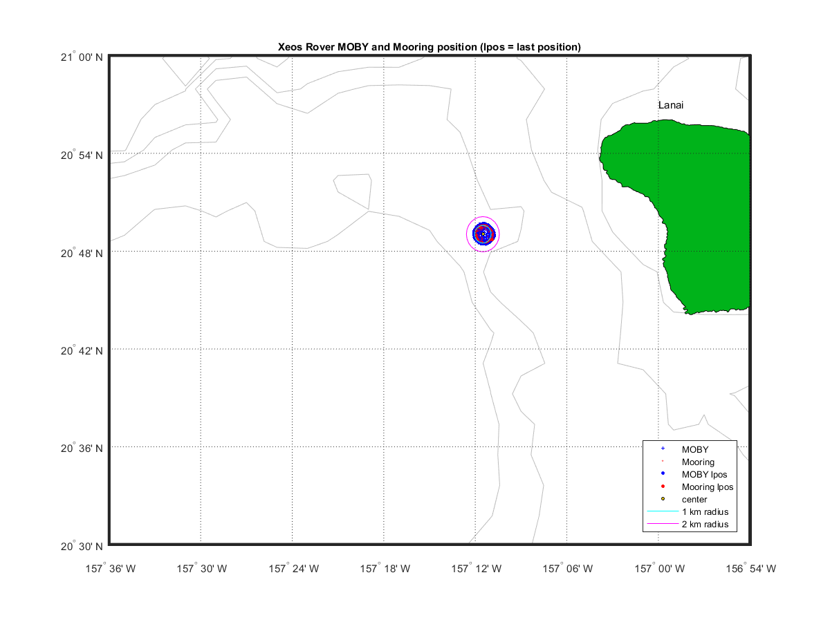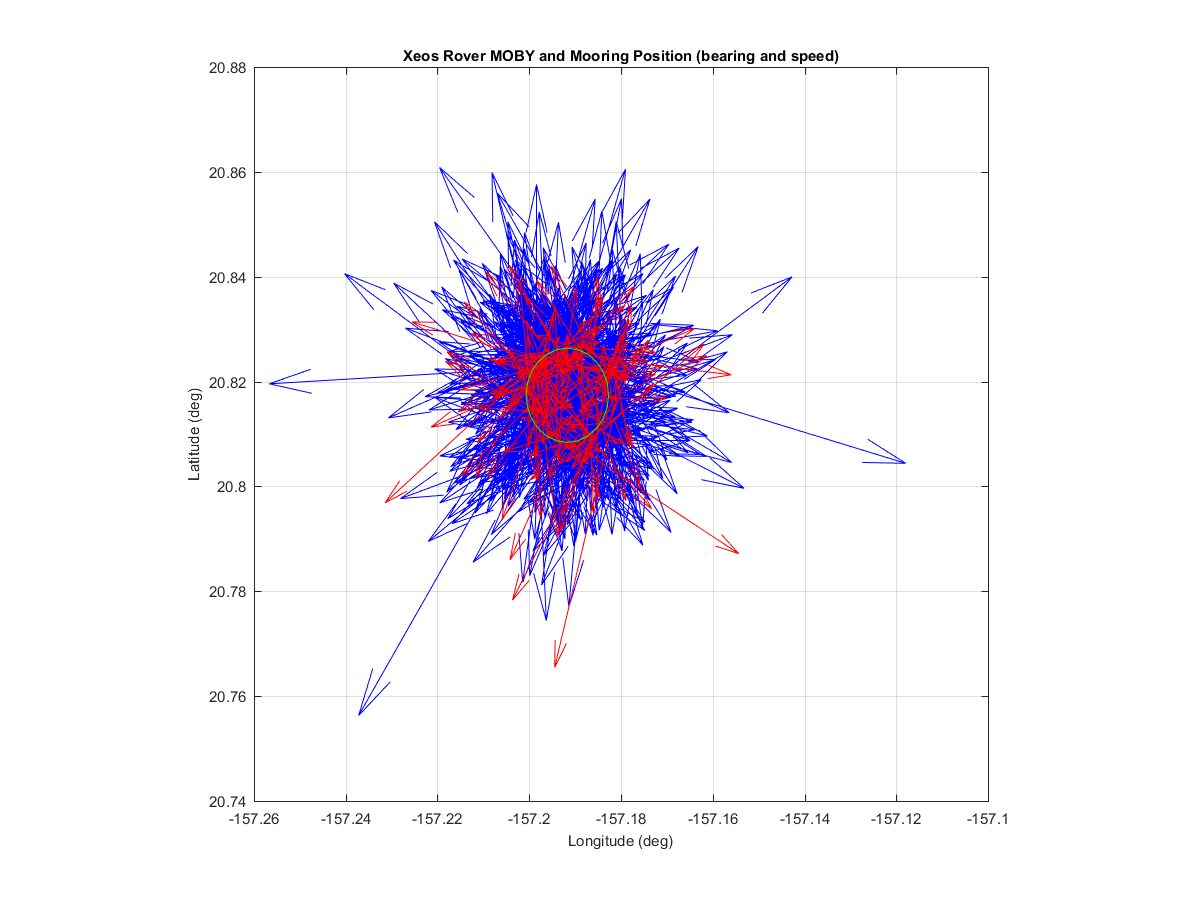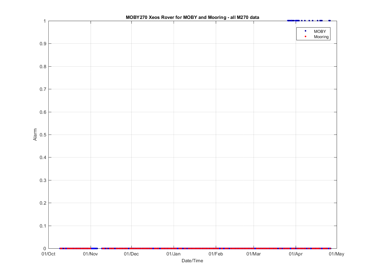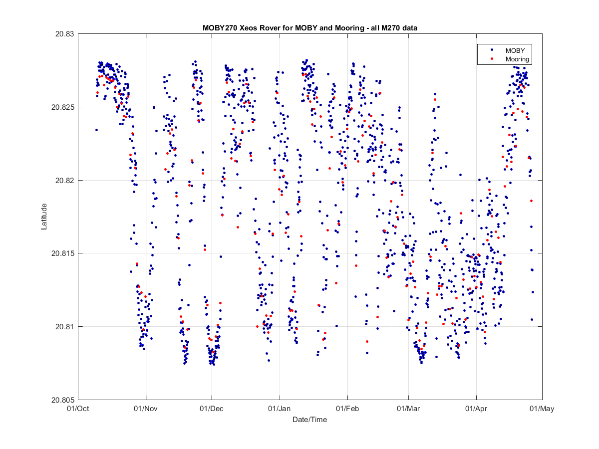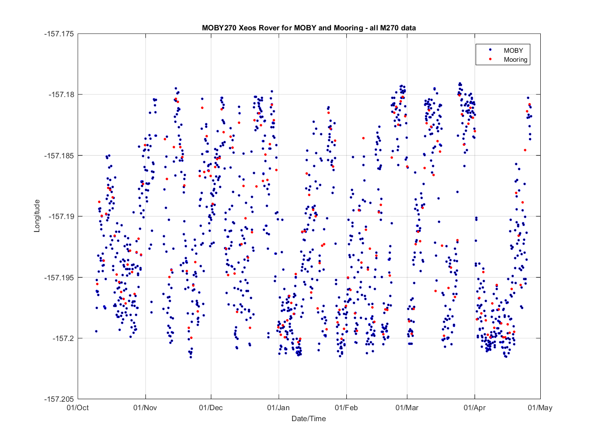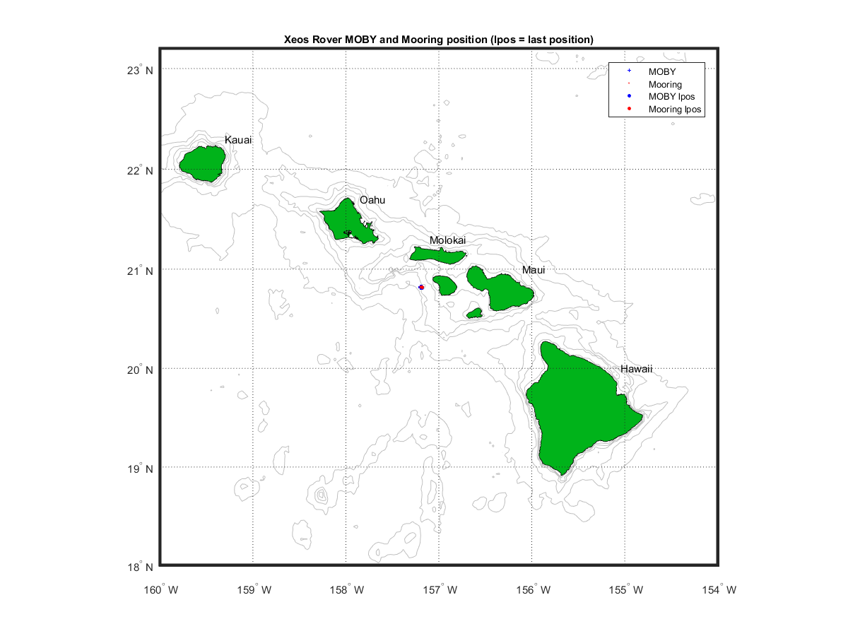
The Rover is an independently powered, self-contained satellite transceiver designed to work in the most rugged ocean environments. There is a Rover on the MOBY buoy and on the Mooring. This allows us to track them separately in case they both go on a walkabout. If the Alarm is on then that means the Rover is more than 2 km from the watchcircle center. The table below shows the last 5 positions for the Mooring and MOBY.
In Sep 2019 a second mooring off Lanai was added. So going forward the heritage northern MOBY buoy mooring location will be called the MO Mooring. And the new southern mooring location will be called the MN Mooring.
Date of Last Email - 26-Apr-2021 21:24:57 (GMT) ---- Date webpage created/updated = 05-Jan-2022 12:49:41 (California Time)
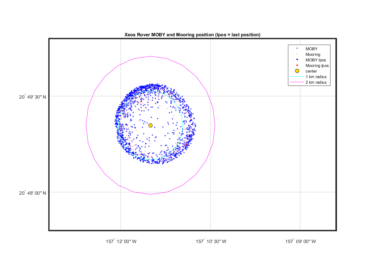
The MOBY watch circle is ~2 km in diameter and located at 20.8174 -157.1917 (decimal deg). MOBY Rover is currently 1.2 km from the watch circle. Mooring Rover is currently 1.1 km from the watch circle.
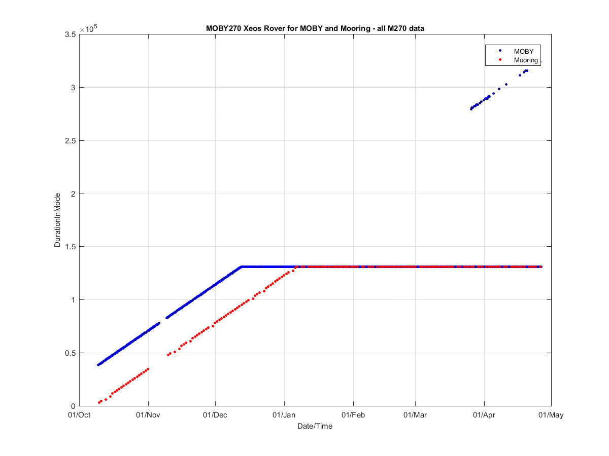
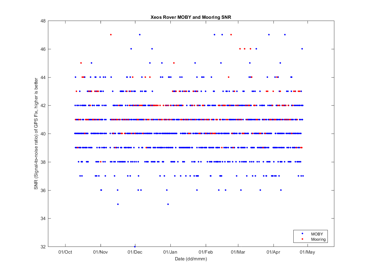
MOBY Rover is currently collecting data every 6.37 hour or every 382.3 minutes. Mooring Rover is currently collecting data every 23.65 hour or every 1419.2 minutes.
| MOBY Date | Mooring Date | Time diff (hours) | Dist between MOBY & Mooring (m) |
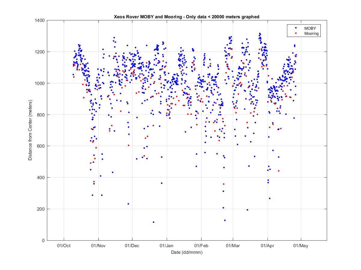
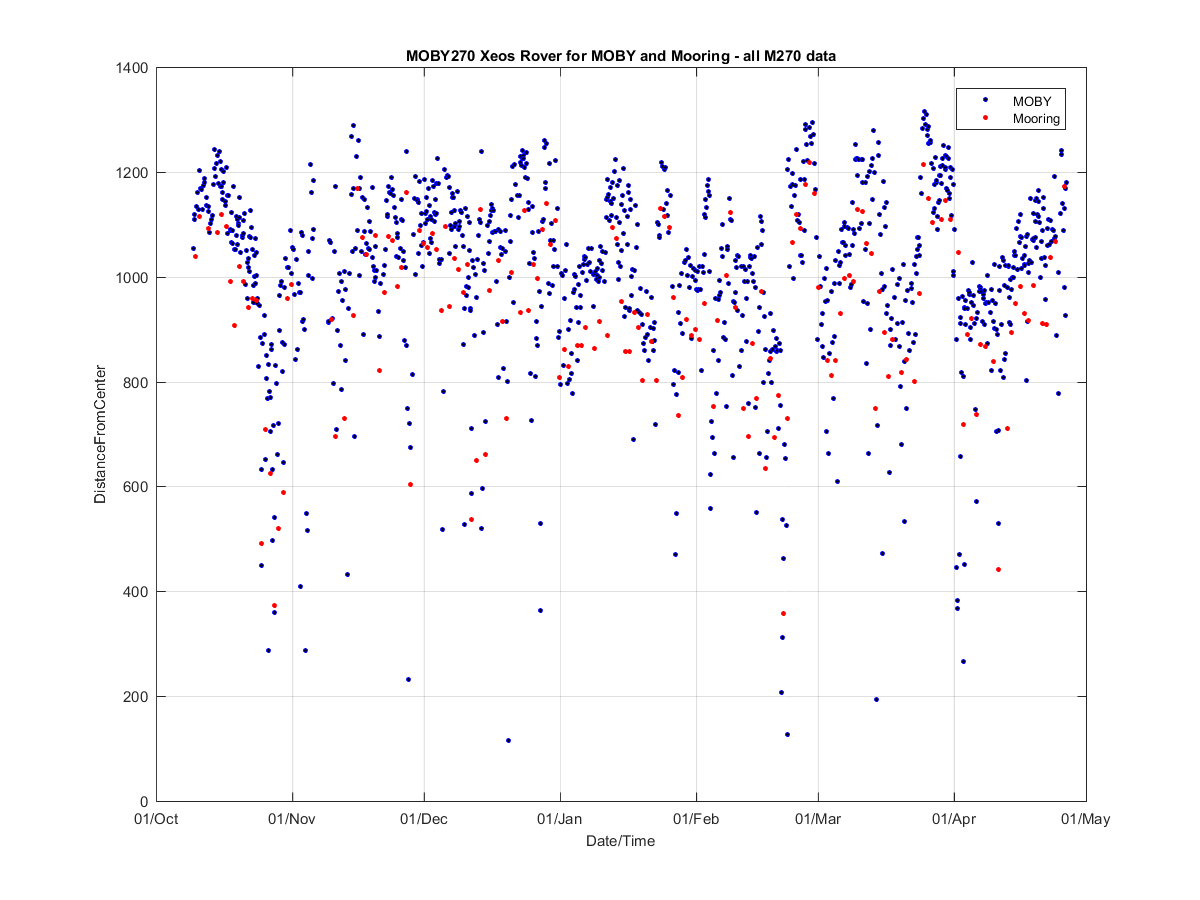
MOBY distance from center (km) |
Mooring distance from center (km) |
|---|---|---|---|---|---|
| 22-Apr-2021 03:00:07 | 22-Apr-2021 00:02:06 | 2.97 | 195.56 | 1.06 | 0.91 |
| 23-Apr-2021 00:46:30 | 23-Apr-2021 00:01:55 | 0.74 | 195.99 | 1.07 | 1.03 |
| 24-Apr-2021 03:02:24 | 24-Apr-2021 00:23:10 | 2.65 | 637.20 | 1.08 | 1.06 |
| 25-Apr-2021 03:02:02 | 25-Apr-2021 00:23:12 | 2.65 | 58.33 | 1.12 | 1.17 |
| 26-Apr-2021 03:01:39 | 26-Apr-2021 00:02:22 | 2.99 | 199.12 | 1.12 | 1.14 |
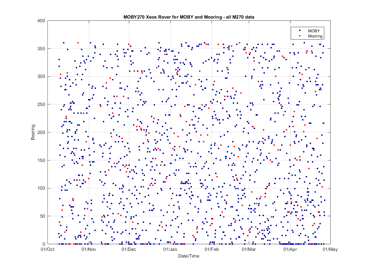
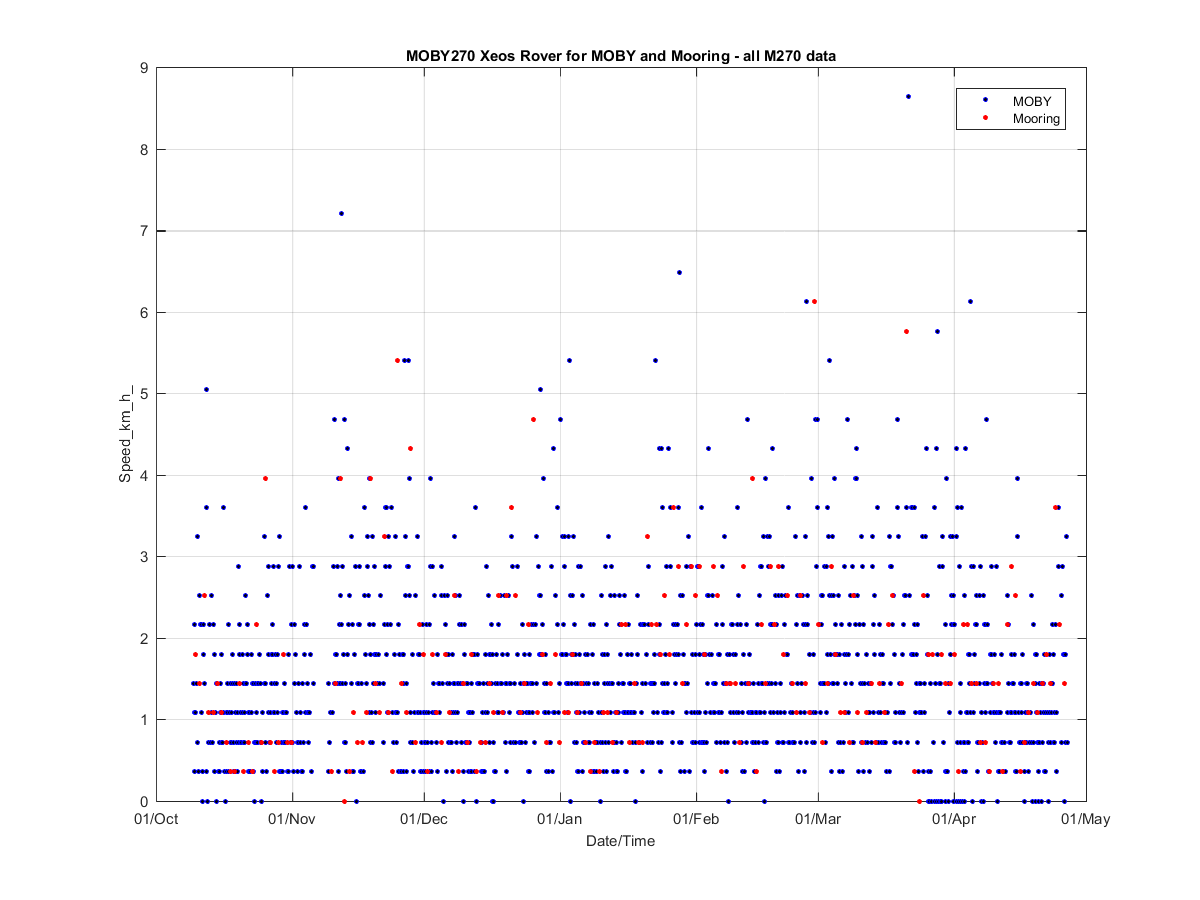
| Instr | Date | Lat (deg) | Lon (deg) | Alarm | Bearing | Speed (km/hr) |
Instr | Date | Lat (deg) | Lon (deg) | Alarm | Bearing | Speed (km/hr) |
|
|---|---|---|---|---|---|---|---|---|---|---|---|---|---|---|
| MOBY | 26-Apr-2021 05:04:30 | 20.8152 | -157.1826 | off | NaN | NaN | Mooring | 22-Apr-2021 00:02:06 | 20.8247 | -157.1956 | off | NaN | NaN | |
| MOBY | 26-Apr-2021 06:02:22 | 20.8139 | -157.1837 | off | NaN | NaN | Mooring | 23-Apr-2021 00:01:55 | 20.8263 | -157.1889 | off | NaN | NaN | |
| MOBY | 26-Apr-2021 09:02:37 | 20.8105 | -157.1833 | off | NaN | NaN | Mooring | 24-Apr-2021 00:23:10 | 20.8243 | -157.1846 | off | NaN | NaN | |
| MOBY | 26-Apr-2021 15:02:36 | 20.8138 | -157.1811 | off | NaN | NaN | Mooring | 25-Apr-2021 00:23:12 | 20.8215 | -157.1814 | NaN | 102.00 | ||
| MOBY | 26-Apr-2021 21:24:57 | 20.8123 | -157.1818 | NaN | 78.00 | Mooring | 26-Apr-2021 00:02:22 | 20.8186 | -157.1808 | off | NaN | NaN |
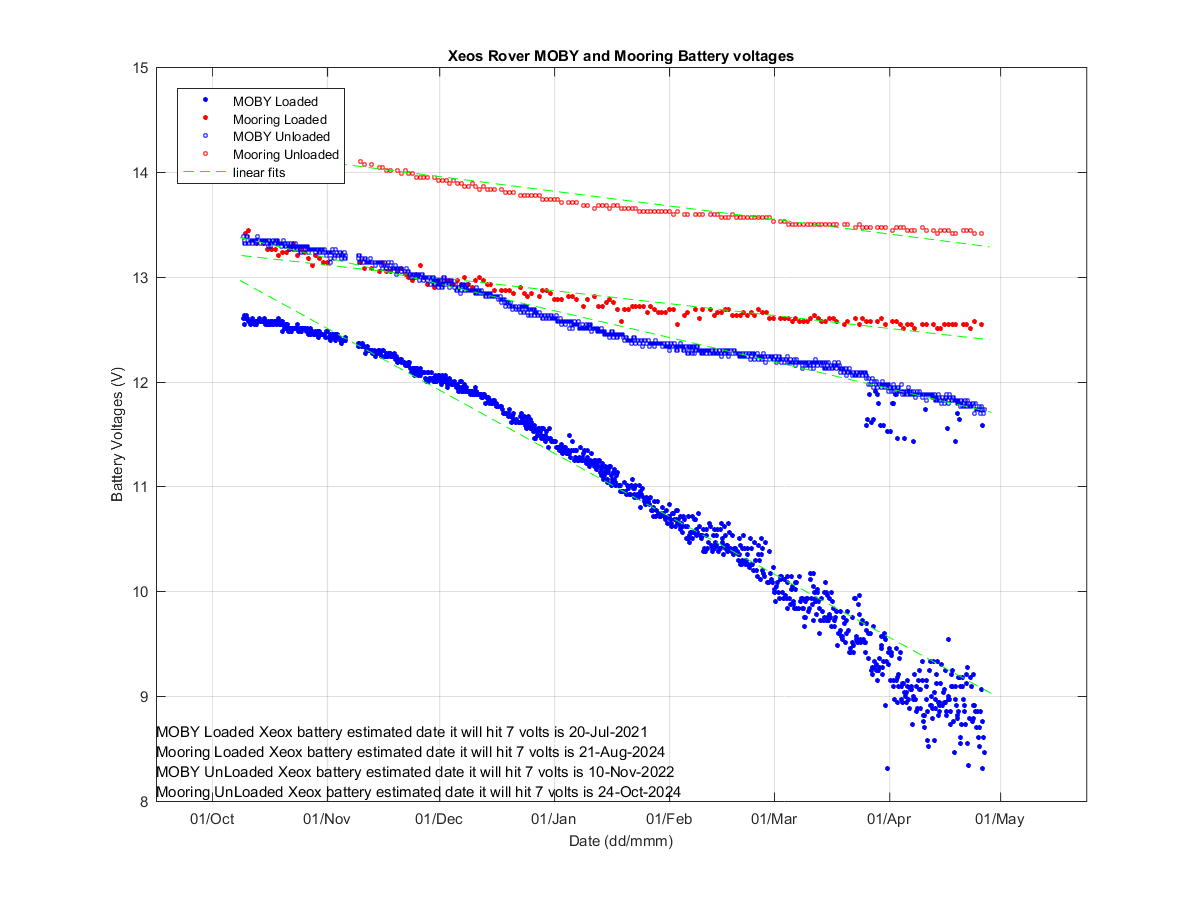
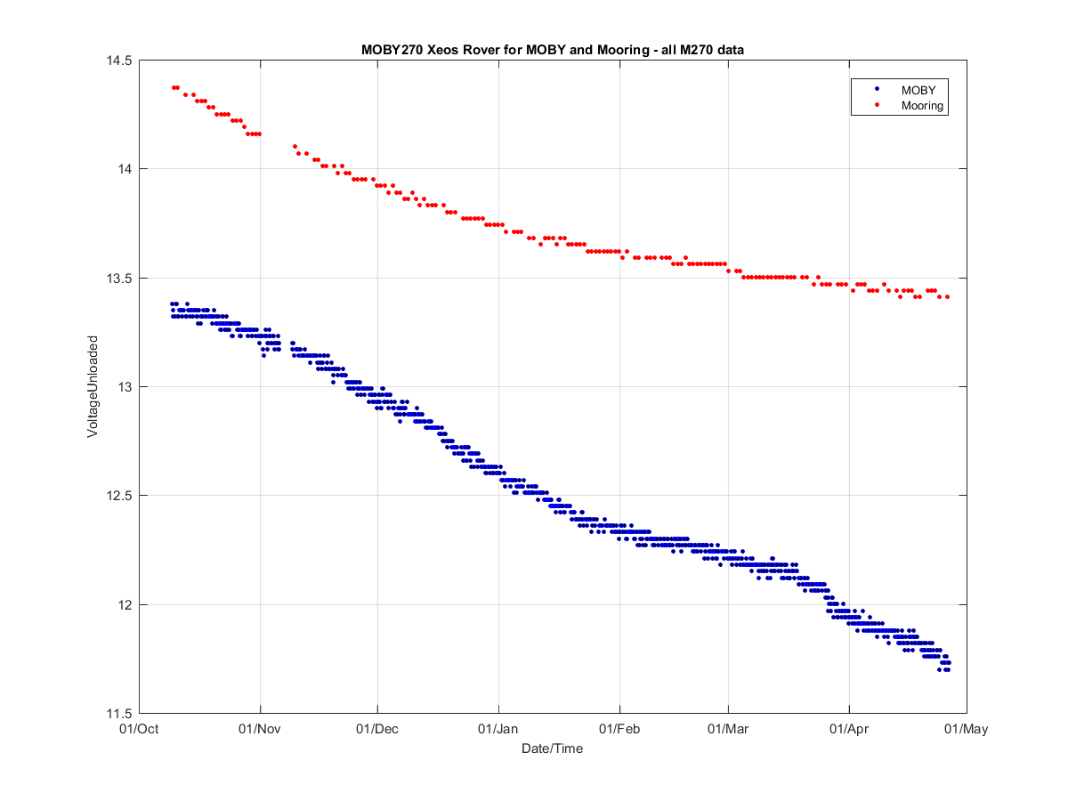
| Instr | Date | Loaded Battery Level (V) |
Unloaded Battery Level (V) |
Instr | Date | Loaded Battery Level (voltage) |
Unloaded Battery Level (V) |
|
|---|---|---|---|---|---|---|---|---|
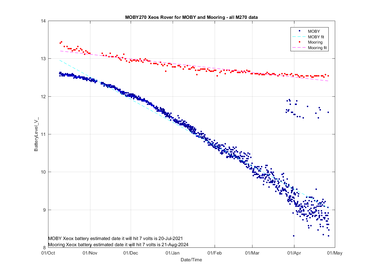
| MOBY | 26-Apr-2021 03:01:39 | 11.58 | NaN | Mooring | 21-Apr-2021 00:01:51 | 12.54 | 13.44 | |
| MOBY | 26-Apr-2021 05:04:30 | 8.76 | 11.73 | Mooring | 22-Apr-2021 00:02:06 | 12.54 | 13.44 | |
| MOBY | 26-Apr-2021 06:02:22 | 8.31 | 11.73 | Mooring | 23-Apr-2021 00:01:55 | 12.51 | 13.44 | |
| MOBY | 26-Apr-2021 09:02:37 | 8.61 | 11.70 | Mooring | 24-Apr-2021 00:23:10 | 12.57 | 13.41 | |
| MOBY | 26-Apr-2021 15:02:36 | 8.46 | 11.73 | Mooring | 26-Apr-2021 00:02:22 | 12.54 | 13.41 |